
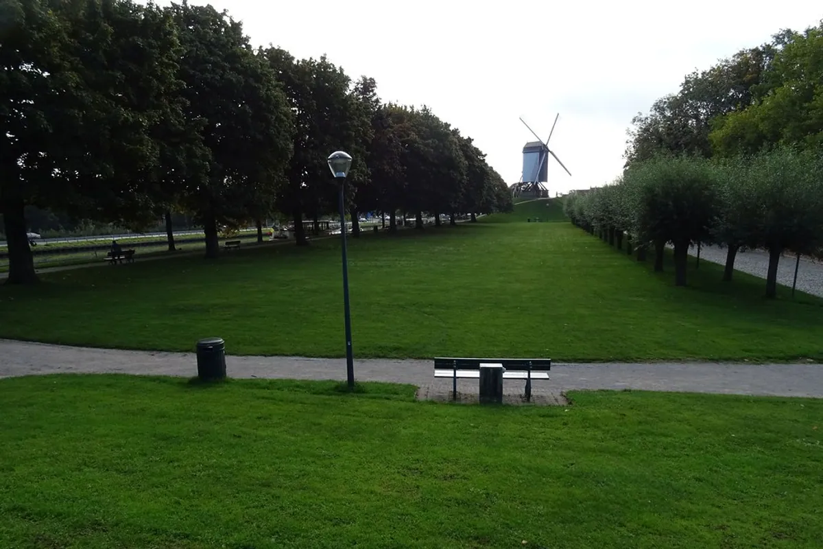


Bruges still has a medieval edge you can walk. Leave Markt behind and the city gradually turns into a green ring of embankments, canals, old gateways and windmills: the Vesten, the remains of the defensive line that once controlled who and what entered Bruges.
Four medieval city gates survive: Smedenpoort, Ezelpoort, Kruispoort and Gentpoort. They are not four versions of the same monument. One carries a macabre story, another rises almost directly from the water, Kruispoort has the most theatrical twin-towered silhouette, and Gentpoort still makes the old road towards Ghent legible. Together they turn an attractive park walk into a readable piece of urban history.
Quick answer
- How many medieval gates survive in Bruges? Four: Smedenpoort, Ezelpoort, Kruispoort and Gentpoort.
- Where are they? Around the historic centre on the Vesten, the green line of the former city fortifications.
- How long are the ramparts? Visit Bruges describes the circular Vesten route as about 7 km.
- Cost: free for the outdoor walk and exterior views of the gates.
- Best way to do it: on foot or by bicycle; allow roughly half a day if you want to stop, read the architecture and include the windmills.
- Is it all medieval masonry? No. The defensive system evolved repeatedly and much of the present Vesten is now landscaped green space. What survives is the shape of the fortified edge, water, embankments and four monumental gateways.
Why the gates sit where they do
Bruges expanded its fortifications at the end of the thirteenth century. The second city wall created a much larger defended perimeter, punctuated by gates on the principal roads leaving town. The surviving gates belong to that outer defensive system, although each was rebuilt, repaired or altered over the following centuries.
That is why the Vesten are more revealing as a circuit than as four isolated sights. Walk the edge and you begin to see medieval Bruges as a controlled organism: roads narrowed through gateways, water reinforced the defences, raised earthworks created barriers and the city could regulate movement between countryside and centre.
For the commercial reason such control mattered, our guide to Bruges as the Wall Street of the Middle Ages explains the trade, port and financial networks protected by those walls.
A good route: Smedenpoort → Ezelpoort → Kruispoort → Gentpoort
You can join the Vesten almost anywhere. Smedenpoort makes a particularly good starting point because it is close to 't Zand and because the western ramparts show the old defensive form unusually clearly. From there, head north to Ezelpoort, continue around the northern and eastern edge towards the windmills and Kruispoort, then follow the ramparts south to Gentpoort. The southern green edge around Minnewater can bring you back towards the station and centre.
The full Vesten circuit is around 7 km. You do not need to complete it to understand the story: Smedenpoort, Kruispoort and the eastern windmills already make an excellent shorter combination. For a broader sightseeing structure, see our two-day Bruges itinerary, which deliberately gives the eastern ramparts more room than a rushed first day usually can.
1. Smedenpoort: the elegant western gate — and the skull
The first Smedenpoort belonged to the late-thirteenth-century fortifications. The present gate largely dates from a rebuilding in 1367, with later alterations. Its pale brick, compact towers and waterside position make it markedly less severe than Kruispoort.
This is also where Bruges' defences are easiest to read in the landscape. On the western Vesten you can still perceive the double embankment and double moat arrangement particularly well. A suspended pedestrian bridge beside the gate gives a useful side view without forcing you into traffic.
Then there is the bronze skull. Local historical interpretation links it to François Vander Straeten, executed after attempting to help enemy French troops enter Bruges in the late seventeenth century. His head was displayed at the gate; today's skull is a later bronze reminder of the story rather than the original remains.
Smedenpoort was also damaged in 1944, when retreating German forces attempted to destroy it, and was subsequently restored. That long chain of rebuilding is a useful warning against imagining the gates as untouched medieval objects.
2. Ezelpoort: a gate almost absorbed by the water
Ezelpoort, at Ezelstraat 122, marks the north-western side of the old city. A gate stood here as part of the 1297 fortification line; the structure was rebuilt in 1369 under Jan Slabbaert and Mathias Saghen and changed again later.
Its setting is the memorable part. The gate stands detached at the water's edge, with the bridge and canal making the defensive logic immediately visible. It is quieter than the eastern windmills and often feels more like a fragment of the old perimeter than a conventional attraction.
Treat it as an exterior heritage stop rather than a museum visit. The reward is the relationship between brick, bridge, water and road.
3. Kruispoort: the most dramatic surviving gateway
On the eastern side, Kruispoort is the gate that most readily looks like a medieval city gate from a storybook: twin round towers, a narrow central passage and small octagonal turrets above.
The history is less tidy than the silhouette. An earlier gate formed part of the late-thirteenth-century fortifications; another was built in the fourteenth century and destroyed in 1382 during conflict with Ghent. The present Kruispoort dates from around 1400.
Its position mattered because this was a ceremonial as well as practical entrance. Historical records associate the route through Kruispoort with notable arrivals including Charles V and, centuries later, Napoleon. In the twentieth century German troops also entered Bruges through this eastern approach.
Kruispoort is one of the best places to combine the fortifications with another side of the Vesten: the Kruisvest windmills. Windmills stood on the ramparts from the Middle Ages, taking advantage of the exposed edge of the city. Sint-Janshuismolen, dating from 1770, is the only one of the four present mills that still grinds grain. If you enjoy free, atmospheric stops rather than ticketed attractions, our guide to free things to do in Bruges fits naturally with this walk.
4. Gentpoort: the road to Ghent made monumental
Gentpoort stands on the south-eastern edge of the centre, where the old route towards Ghent crossed the fortifications. The first gate belonged to the late-thirteenth-century system; the present structure was built in the early fifteenth century.
Its broad brick façade and projecting towers are easier to appreciate from the outer side and the bridge. The building was once part of the Musea Brugge network, but it is no longer operated as a museum: plan this as an exterior stop and as part of the ramparts walk.
There is one current practical wrinkle. Gentpoortbrug reopened to traffic on 1 September 2026, but reconstruction works around the Gentpoort junction are still continuing. Pedestrian and cycling access in the area can therefore be diverted locally. Follow the signed route rather than treating an older map as turn-by-turn instructions.
The Vesten are more than the four gates
The gates are the anchors, but the most convincing part of the walk is everything between them. The city ramparts cover roughly 26 hectares, contain more than 3,000 trees, and form a continuous green counterweight to the dense historic centre.
Along the eastern side, windmills turn the former defensive crest into an open skyline. In the west, the double earthworks and water make the fortification logic clearer. Towards the south, Minnewater, the Poertoren and waterside paths soften the transition back into the postcard city.
This is why the Vesten work particularly well after you have already seen Markt and Burg. They change the scale. Instead of looking at Bruges building by building, you begin to understand the outline that held the medieval city together.
For another walk where small places reveal the social structure behind the façades, continue with our route through the hidden almshouses of Bruges.
Walking or cycling?
Walking is better if the gates themselves are the point. You can stop on bridges, change sides of the water and notice details without constantly remounting.
Cycling is better if you want the whole 7 km green ring and the Vesten as a landscape. The ramparts are one of the city's natural recreational corridors, but pedestrians and cyclists share parts of the route, so speed is not the objective.
Either way, ordinary city footwear is enough in dry weather. Expect historic paving, bridge approaches and occasional uneven surfaces. For mobility-sensitive planning, combine this article with our accessible Bruges guide; the existence of a green route does not mean every approach to every gate is uniformly step-free.
Is the ramparts walk worth it on a first trip?
Yes — especially if you have more than one day. The gates are not as individually famous as the Belfry or Burg, but the circuit explains something those central monuments cannot: where medieval Bruges ended.
If time is tight, choose Kruispoort plus the windmills, or Smedenpoort plus the western ramparts. If you have two or three days, the full green edge is one of the best ways to escape the busiest streets without leaving Bruges at all.